
:quality(75)/cloudfront-us-east-1.images.arcpublishing.com/elcomercio/RKZCRM34XRD7RP7XWQO3B4LX2E.jpg)
All it takes is a storm in the wrong place at the wrong time to unleash chaos.
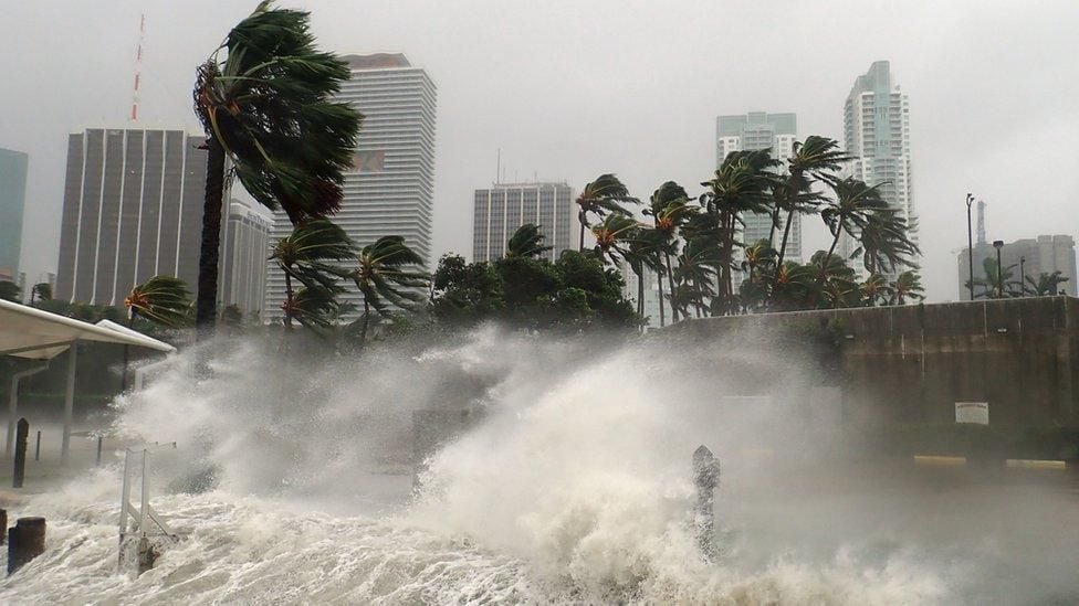
That’s what people in Florida (USA) learned last year, when a near-normal hurricane season unleashed one of the deadliest tropical cyclones in US history, Hurricane Ian.
LOOK: The growing number of Ukrainians who do not want to fight for their country in the war against Russia
Combined with the damage Hurricane Fiona caused in Puerto Rico, it was the third costliest season on record.
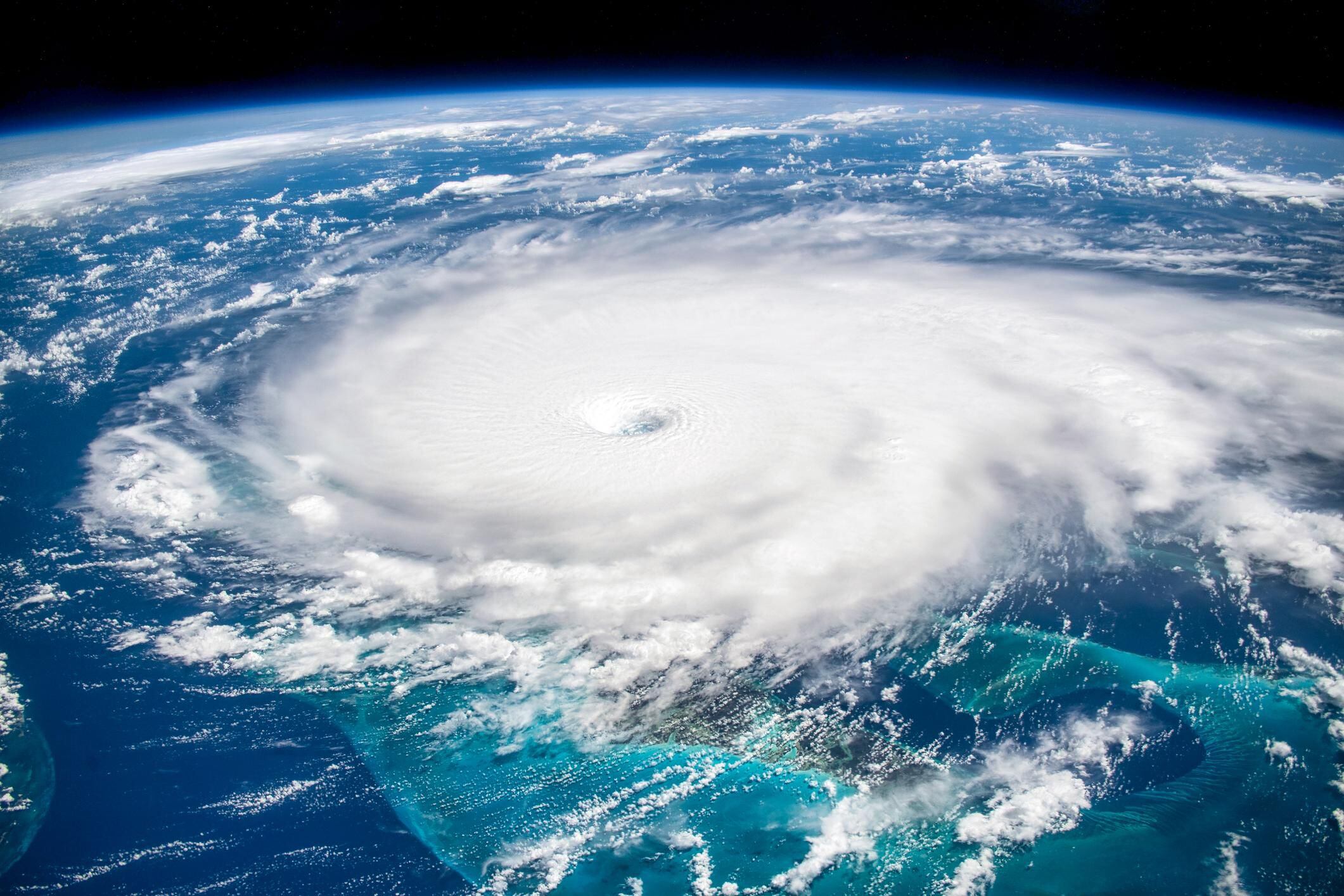
Anticipating disasters of this type is not easy. The intensity of a tropical storm and where it strikes are determined by weather patterns that are highly unpredictable beyond a few days.
But scientists can at least offer an overview of how each hurricane season will play out.
By tracking the development of various linked oceanic and atmospheric patterns, researchers can make predictions based on what they’ve learned from decades of data.
Earlier this month, scientists from the US National Oceanic and Atmospheric Administration (NOAA) updated their predictions for 2023 Atlantic hurricane activity, warning that now it’s likely to be an above normal season with more storms and hurricanes than those observed in an average year.
Record-breaking ocean temperatures and unusual wind patterns in the atmosphere are contributing to a complex push-pull effect that drives hurricane occurrence.
The researchers also recently drew attention to a little-studied phenomenon that may represent another key factor in determining the outlook for the hurricane season.
A vast expanse of water extending from the west coast of equatorial Africa experiences periodic fluctuations in temperature known as the Atlantic Niño. or “El Niño’s little brother”.
New research suggests that this cycle of changes in Atlantic Ocean surface temperatures may fuel some of the most powerful hurricanes to hit the Caribbean and the United States.
The El Nino effect
Of the many weather systems that shape the birth of tropical storms in the Atlantic Ocean, two typically stand out.
The El Niño-Southern Oscillation (ENSO) is a global weather pattern that forms in the Pacific and fluctuates between the warming phase of El Niño and the cooling phase of La Niña.
During El Niño, warmer-than-average Pacific Ocean temperatures drive global atmospheric circulations and increase the vertical wind shear in the Atlantic.
Hurricane systems like to stay upright, so when the wind shear (the difference between the speed and direction of winds blowing at different altitudes) is high, they are at risk of tipping over and breaking apart.
In contrast, El Niño also the risk of tropical cyclones in the Northeast Pacific increases.
The arrival of Tropical Storm Hilary on the west coast of Mexico and southern California – the first in that state since 1939 – has been attributed to the current phase of the weather pattern.
Back in the Atlantic, the second determinant of hurricanes is the Atlantic Meridional Mode (AMM), which accounts for fluctuations in low-level winds and tropical sea surface temperatures in the ocean.
So when the WMA is in positive mode, ocean temperatures will be warmer than usual and offer more heat, fueling storms that pass overhead.
However, there are many factors that determine whether a hurricane forms, how powerful it becomes, how long it lasts, and where it makes landfall.
the other child
Both ENSO and MMA involve the interaction of oceanic and atmospheric circulations, and measuring their impact on sea surface temperature helps predict hurricane activity, says NOAA oceanographer Hosmay López.
But both weather systems also have different locations where they are dominant.
The WMA has a strong impact on storm formation in the central tropical Atlantic basin. Meanwhile, the ENSO usually has its greater influence on hurricanes that form in the Caribbean and the Gulf of Mexico.
Conversely, the weather pattern known as the Atlantic Niño can have a major influence on storms that form off the coast of West Africa.
This third potential predictor of hurricane activity involves ENSO-like dynamics.
However, since it takes place in the smaller Atlantic Ocean, its global impacts are less pronounced than those of its big brother in the Pacific, and its effect on Atlantic hurricanes has been less studied…until now.
“We have known about the existence of the El Niño del Atlántico for many years,” says López, who was part of the team that discovered its role in hurricane development.
“Only recently has there been more scientific curiosity.” Especially since it has been seen to influence some globally important climates, such as rainfall in the Sahel and the North African monsoon.
It was already known that many of the most destructive hurricanes have an unlikely place of origin: in atmospheric disturbances over the Sahara desert and the Sahel.
These can generate storms that swirl over the Atlantic Ocean near the Cape Verde archipelago off the coast of West Africa.
Here they can feed on the warm tropical waters until they become hurricanes, and the warmer the ocean, the more energy hurricanes can store.
And this is where the Child of the Atlantic can play a role.
Tropical storms that form in the Gulf of Mexico are closely encircled by the surrounding land, which means they have a high chance of making landfall, but less time to pick up the energy they need to become high-force hurricanes.
But the so-called Cape Verde hurricanes have had plenty of time to travel over the ocean and absorb its heat.
As a result, Cape Verdean hurricanes account for 80-85% of all major hurricanes that hit the US and the Caribbean.
Therefore, the El Niño del Atlantico can have a huge influence on the destructive potential of a hurricane season, as it fuels some of the most intense storms in the Atlantic Ocean.
The El Niño weather pattern remains the most dominant in terms of global climate impact, says López, “but the [tres] They add something in terms of improving the hurricane outlook system.”
“We cannot say that one is more important, because then we will stop learning new things,” he adds.
“Clash of titans”
So what does the newly understood influence of the Atlantic Child mean for current hurricane predictions?
This year, not much. The Atlantic El Niño is currently in what is known as the “neutral phase”, that is, in the transition between cold and warm fluctuations.
“It is not clear at this time if the Atlantic Child condition will develop this year,” says Dongmin Kim, another of the NOAA scientists involved in the research.
That means scientists are focusing on the signals provided by ENSO and MMA, which this year are in an ocean-scale tug-of-war.
Most forecasts in March-April predicted a near- or below-average hurricane season, as the damping effect of El Niño wind shear was expected to be significant, says Phil Klotzbach, an atmospheric scientist at California State University. Colorado.
But while El Niño is developing rapidly, it takes a while to build up, and in the meantime, sea surface temperatures in the Atlantic are at record levels.
This has now put the chances of an “above normal” hurricane season at around 60%, according to NOAA’s August forecast.
“I consider this a fight of the titans,” says Klotzbach. “If we also had La Nina, we’d be heading for a crazy, fast-paced season, but as these factors play against each other, we’re going for a moderate season.”
Climate change too is leaving its mark on hurricane formation.
Research predicts that while the Atlantic El Niño could weaken in response to global warming, man-made global atmospheric warming itself has in turn helped set things up for more intense hurricanes.
More research is needed to fully understand the impact of such warming on the planet’s weather patterns.
And improved satellite data is helping here. As well as multinational projects such as the Pilot Research Network of Fixed Buoys in the Tropical Atlantic (Pirata), a set of moored buoys that observe oceanic and atmospheric variability in the tropical Atlantic.
This year, however, those living in areas most commonly affected by hurricanes are being warned to prepare for a hyperactive season.
With more storms forecast, they also increase the chances of them hitting land.
Researchers at Colorado State University estimate that the chance of a major hurricane making landfall somewhere along the US coast is about 48%, a slight increase from the long-term average of 43%.
“If you throw 300 darts at the bull’s-eye, chances are you’ll hit the target,” says Klotzbach.
The message from NOAA forecasters is to be prepared.
Source: Elcomercio
I am Jack Morton and I work in 24 News Recorder. I mostly cover world news and I have also authored 24 news recorder. I find this work highly interesting and it allows me to keep up with current events happening around the world.

:quality(75)/cloudfront-us-east-1.images.arcpublishing.com/elcomercio/DEI6WKKKSRDB3E2GHYLSIN2VYE.jpg)


