
:quality(75)/cloudfront-us-east-1.images.arcpublishing.com/elcomercio/GI4TCMZNGEYS2MJSKQYDAORSHE.jpg)
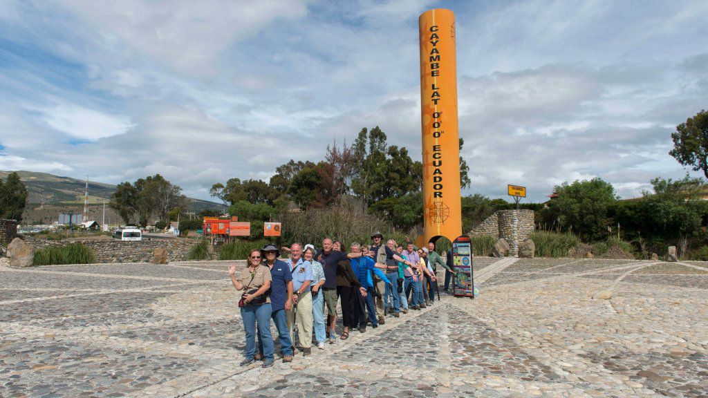
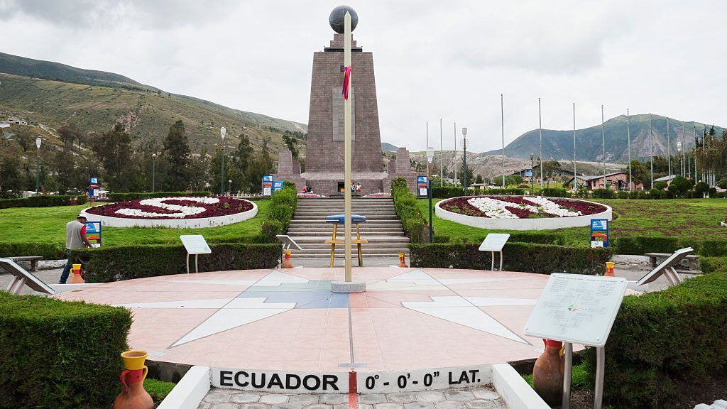
“Ecuador means ‘the middle of the world’ and, obviously, that is tied to the French geodesic mission, which defined the point in the center of the world where the monument is at this moment,” Jorge Eduardo Carrera, from the City, told the BBC. Half of the world.
From 1734 to 1744, the French Academy of Sciences launched several expeditions to determine the actual shape of the Earth.
Look: What was the Great Moon Hoax and why did so many buy into such an outlandish fantasy?
The French geodesic mission verified Isaac Newton’s theory that the planet was flattened at the poles and wide around the terrestrial equator, also known as the 0° parallel or equator line.
But the dividing line they drew was not precisely at the actual 0° latitude.
“They were ‘wrong’ by a few meters. Today with the GPS you can see that the exact point is very close here, but the reference is here, in the most visited site in continental Ecuador,” says Carrera.
Despite the mistake, hundreds of thousands of tourists come every year to that half of the world established more than three centuries ago to walk that line that, although imaginary, is painted yellow.
Expedition to the Andes
“The geodesic mission that arrived in Ecuador found itself in a country full of small hills and very high mountains where they had to triangulate to be able to measure what they wanted to measure,” says María Patricia Ordóñez, from the San Francisco de Quito University.
“And you also have to keep in mind that the country was in the midst of a lot of political changes, so the work of the geodetic mission was difficult from the beginning.”
One team was sent to Finland and another to the Andes to apply different methods, including triangulation.
“Another method was that of the pendulum, in which the idea is that the closer you are to the middle, the pendulum moves in a different way,” explains Ordóñez.
This is because, because of its equatorial bulge, Earth’s gravitational pull is slightly weaker at the equator.
“And the third is through the stars.”
Heaven
But the French were not the first to look at the stars in these lands.
Even before the arrival of the Incas and Spanish, the people who ruled and lived in the equatorial Andes, known as the Quitus were already looking for answers in the skies.
“Science does not come only from the Western world; ancient cultures also created science and technology, and there is evidence, that they have lasted thousands of years,” says anthropologist Esterlina Quinatoa Cotacachi.
“They knew they were at the center of the world, and they knew what all the effects of the Sun meant.
“The management of astronomy was very important, especially for agricultural cycles, but much more.
“It is said that the Incas came here to the north in search of the straight Sun.”
Y “Quito is the place of the right Sun and right time”says the expert in Andean calendars Gustavo Guayasamin.
The solar calendars of Mexico, Guatemala and Colombia, Bolivia, northern Argentina, and Chile project asymmetric shadows, he explains.
“Quito is the place where you can count the time of a year and that enters two arms (shadows) exactly the same.”
During 6 months the shadows are projected to the right side and in the other 6 months, to the left, he explains.
“And it’s exactly the same size, and that’s why time in Quito closes in a single circle.
“That circle with a cross in the center is the square cross, the Cruz de Quito.”
The sky
Over the years, the equator has moved a few meters to one side and a few meters to the other, and despite the advent of highly sensitive GPS that promised to fix it hopelessly, several places in Ecuador claim to be the true half of the world.
One of them is the top of Cerro Catequilla, whose name comes from “Kati Killa”, “the one who follows the Moon”.
“In Catequilla there is also a semicircular construction that is not Inca: it is pre-Inca,” says Cotacachi.
“Catequilla is a very important place because you can see the entire Milky Way.”
“One of the peculiarities of this region is that only at 0° latitude can we observe absolutely all the stars in the firmament“, highlights the archaeoastronomer Cristóbal Cobo.
“If we go to the north, for example to Mexico, or to the south of Peru, we can no longer see some stars.
“On the equatorial line we can see 100% of the stars, so here an integral awareness of the observation of the celestial vault was possibly generated.”
Everything
The problem is that this territory has been conquered twice, so there is little archaeological evidence from before the Incas.
However, linguistics can fill in the historical gaps.
Tsafiki is a pre-colonial language spoken to this day by a small minority of people and it offers us a clue.
“In Tsafiki, ‘Quit-sa’ means half and ‘To’ means world: half of the world. Possibly the source of the name Quito. ‘Quit’ means half, ‘To’, world.”
To determine the middle, one must first find the whole..
So how advanced were the pre-Hispanic peoples and were they able to recognize the actual shape of the Earth?
“The idea of a square, flat earth comes from medieval Europe, where obscurantism arose and obscured knowledge, but it seems not in America.
“I believe that in these aspects these American cultures, as Mayan mathematics has shown us, were much more advanced than other cultures around the world.
“Those people were very wise about the use of natural resources such as water, soil, and biodiversity.
“Now we have to see history with pragmatism, understand that each archaeological site is a source of information on the intelligent use of natural resources, to be able to rescue ecological niches, streams, for intelligent use of water, soil for crops.
“That’s the direction that science is taking now and into the future.”
Source: Elcomercio
I, Ronald Payne, am a journalist and author who dedicated his life to telling the stories that need to be said. I have over 7 years of experience as a reporter and editor, covering everything from politics to business to crime.

:quality(75)/cloudfront-us-east-1.images.arcpublishing.com/elcomercio/6RXJ557WFRAPTLWWMV3EPDQWBQ.jpg)
:quality(75)/cloudfront-us-east-1.images.arcpublishing.com/elcomercio/5GXSVTGF6BFWTLZUJIDSGEKHHQ.jpg)
:quality(75)/cloudfront-us-east-1.images.arcpublishing.com/elcomercio/7UP36SD2RFFVXP6J2Q274SPQNE.jpg)
:quality(75)/cloudfront-us-east-1.images.arcpublishing.com/elcomercio/VNKVF3HCAJCZTCBTQGMOOLZNM4.jpg)
