
:quality(75)/cloudfront-us-east-1.images.arcpublishing.com/elcomercio/QTMWAYQ3SJEQ5HQBPHT5SR3OTA.png)
Aristotle, Eratosthenes and, later, the cartographer Ptolemy called it Terra Australis Ignota.
In search of this imaginary continent, which in classical Greece was believed to have existed on the other side of the world due to geometric symmetry, Dutch explorer Abel Tasman found in 1642 a new land, the islands we know today as New Zealand. But this seemed too small to be what I was looking for.
LOOK: The Venezuelan migrant who went into labor on the roof of a La Bestia train, in Mexico
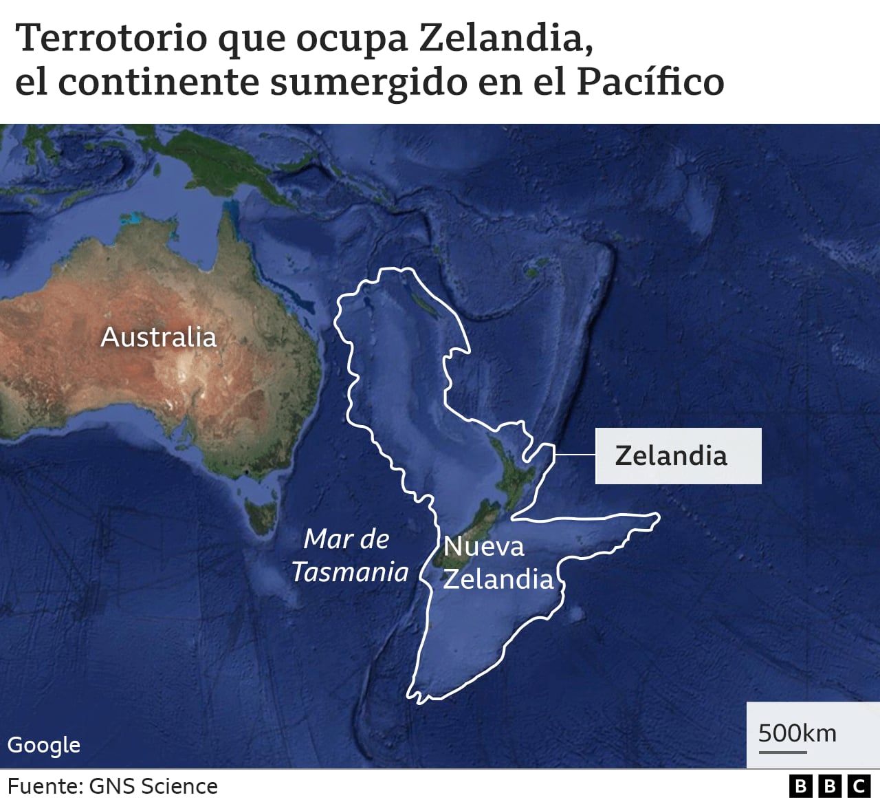
It took 375 years to confirm that the continent, called Zealandia, actually exists, although it was practically invisible to the naked eye: It is 94% submerged.
Now, a new study has managed to complete the definitive map of Zealandia or, as it is known in Māori, Te Riu-a-Māui.
In a study published in “Tectonics”, scientists from New Zealand’s GNS Science created a new detailed map of Zealandia’s boundaries, which they were able to trace thanks to rock samples dredged from the ocean floor.
The continent extends along 5 million square kilometersand only now has its full surface been established.
Its history is linked to that of Gondwana, the ancient southern supercontinent that, when divided hundreds of millions of years ago, created the continents we know today and which, depending on the country in which it was studied, could be six or seven.
Zealandia separated around 80 million years ago but, unlike neighboring continents Antarctica or Oceania, Most of its territory was submerged.
Basalts, sandstones and pebbles
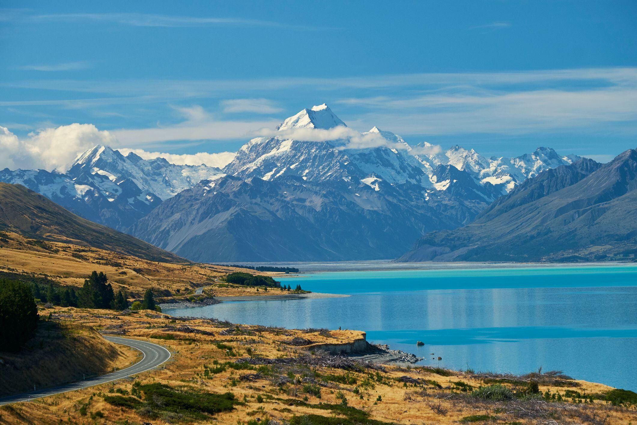
The only land left on the surface are the islands of New Zealand, the French territory of New Caledonia, and the tiny Australian territories of Lord Howe Island and Ball’s Pyramid.
Because it is submerged, Zealandia has been studied little and little, creating inconsistencies about its shape and limits. Until now, only the southern part of the continent had been mapped.
With new research led by geologist Nick Mortimer, the remaining two thirds have been defined and existing maps have been refined, so “land and marine reconnaissance geological mapping of the entire 5 million km2 continent of Zealandia is now complete”, the study notes.
To achieve this, the team of geologists and seismologists studied samples of rocks and sediments collected from the bottom of the ocean, mainly through drilling, and also the specimens that appeared on the coasts of islands in the region.
They were analyzed and dated basalts, sandstones and sandstone pebbles. The researchers found that the sandstones were Late Cretaceous (about 95 million years old) and contained granite and volcanic pebbles from the Early Cretaceous (130 to 110 million years old). The basalts have been dated to the Eocene (about 40 million years old).
These results, along with data from regional magnetic anomalies and information from other studies, helped scientists map the underwater geology of northern Zealandia.
After the first European sighting in 1642 by Abel Tasman (who would later name the island of Tasmania), other explorers and scientists scoured the waters off Zealandia in search of the lost continent. not realizing that they were floating above him.
The first real clues to its existence were gathered by Scottish naturalist James Hector, who in 1895 studied the islands off the south coast of New Zealand and concluded that the country is “the remnant of a mountain range which formed the crest of a great continent continental”. area that extended to the south and east, and which is now submerged.”
Then, in 1995, American geophysicist Bruce Luyendyk returned to the described the region as a continent and suggested calling it Zealandia.
Does this change?
Continental crust is generally about 40 km deep and is significantly thicker than oceanic crust, which is typically only about 10 km deep.
Zealand has some 20 km deep because its platform extended greatly when it separated from Gondwana. Being so thin, it eventually sank, although not to the level of normal oceanic crust.
Scientists argue that, both due to the height of its crust and the type of rocks that make it up, Zealandia is definitely a continent.
In addition to scientific interest, will anything change if researchers define Zealandia as a new continent?
Yes.
According to United Nations Convention on the Law of the Seacountries can extend their legal territories beyond their Exclusive Economic Zone, which reaches 370 km from their coasts, to claim their “extended continental shelf”, with all the mineral and oil wealth that it encompasses.
By proving that it is part of a larger continent, New Zealand could increase its territory six times.
This has meant that funds for marine exploration have multiplied in recent years.
Source: Elcomercio
I am Jack Morton and I work in 24 News Recorder. I mostly cover world news and I have also authored 24 news recorder. I find this work highly interesting and it allows me to keep up with current events happening around the world.


:quality(75)/cloudfront-us-east-1.images.arcpublishing.com/elcomercio/KNQ4BJPCBJDCDNUCHPQVA6V5D4.jpg)
:quality(75)/cloudfront-us-east-1.images.arcpublishing.com/elcomercio/BXSJVBKUMVEHFGNSSRDTASTBGY.jpg)
:quality(75)/cloudfront-us-east-1.images.arcpublishing.com/elcomercio/72Z4LY37UBADXH2F5PV3YCQ3OU.jpg)
